Tag Archives: kent

This Halloween, visit the church that isn’t there

If you’re looking for somewhere a little bit spooky to explore this Halloween, I may have just the place for you: a remote, abandoned graveyard on top of a hill, surrounded by bleak marshland.

chapel bank graves

The question everyone asks when they visit Chapel Bank, at the edge of Romney Marsh, is what these graves are doing here out  in the middle of nowhere. The clue is in the name – there used to be a chapel on top of the hill. But in 1858 the local parishioners decided to move it (although not before the woman who the Granny Smith apple was named after was married here!). The entire building was moved a mile and rebuilt at Reading Street, where you can still see it today. It must have been quite a task – dismantling it more or less by hand and transporting the stones by horse and cart, so why go to all this trouble? Quite simply, it was falling into disuse – the villagers who had worshipped in the church had mostly moved away.

chapel bank romney marsh

Yes, there was a village on this remote hill as well – a village called Ebony. The name has nothing to do with the wood ebony – it comes from the Anglo-Saxon Ebon Ie, which means ‘Ebon’s Island’. This land used to be surrounded by wide tidal channels and could only be accessed by ferry. In the 16th century, nearby Smallhythe was a busy centre for shipbuilding, where many of the people of Ebony were employed. If you’d stood on this hill in 1537, you might have seen one of Henry VIII’s brand new warships sail past.

chapel bank ebony church yard

Silting up of these channels brought the decline of this industry and the population began to shrink. That led to the church falling into disuse and the decision to move it. Now its hard to believe anyone ever lived or prayed on this barren hilltop at all. But a pilgrimage from the church in it’s new location to the graveyard still takes place every year.

ebony church yard

This evocative place has a lot of secrets to offer up – standing in this bleakly beautiful spot, perhaps you’ll feel the presence of those long departed villagers. Where could be better for an All Souls’ Eve wander? You’re guaranteed to sense the ebb and flow of history.

graveyard ebony island

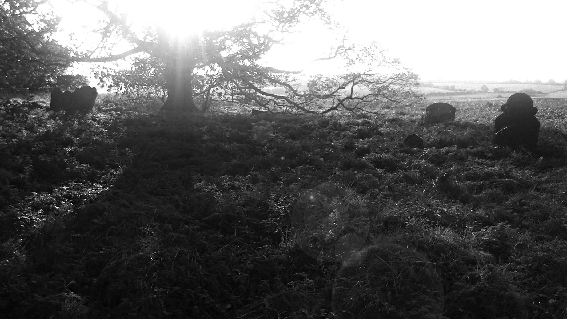
What can’t be guaranteed of course is the weather. Most of the photographs here were taken on October 31st 2014, in bright sunshine and 20 degrees C – not very Halloween-like!

Where to go

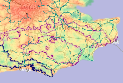
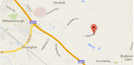
Chapel Bank can only be reached on foot – park at the villages of Stone in Oxney or Appledore, south of Tenterden in Kent, and use public footpaths to reach the hill top.

chapel bank kent


Celebrate World Rivers Day with a meander along the water

Tomorrow is World Rivers Day, and to inspire you to get out and enjoy some of the fantastic waterways we have in the south-east, here are some images showing the tremendous beauty and variety of the rivers in Kent.

This slideshow requires JavaScript.

And here are some walk routes to get you started:

Medway River Walk

Stour Valley Walk

Darenth Valley Path


Reshaping the White Cliffs

One of the things I look forward to at this time of year is the drama of autumnal weather. Living on the coast I often see how a storm that lasts just a few hours can make a lasting impression on a coastline.

One of my favourite places to see this dynamic process in action is the towering Abbot’s Cliff between Dover and Folkestone.

This slideshow requires JavaScript.

The soft chalk cliffs are exposed to everything the English Channel can throw at them. New landscape features and habitats are always taking shape here, from the small-scale to the dramatic. Enormous rock falls  expose new cliff faces, and natural processes create some unusual niches for wildlife. It really does go to show that coasts like this are ever-changing landscapes.

Where to go

Samphire Hoe map

The easiest way to access Abbot’s Cliff is from Samphire Hoe. Walk west away from the car park, walk right through the Hoe and you will come to the beach under Abbot’s Cliff. Check tide times before you leave and beware tide cutting you off.

Samphire Hoe website.

Marbled whites and Eurostars

The Channel Tunnel terminal has been in the news for all the wrong reasons recently. Queuing lorries, French strikers, traffic chaos.

Overlooking the terminal, high above the roar of the Eurostar trains and endless processions of trucks, is one of Europe’s most valuable grasslands – the Folkestone Downs. Its 270 hectares of chalk downland are protected by UK and European law. This habitat is a natural ‘Euro-star’.

Folkestone Downs
Folkestone Downs

At this time of year its sheltered parts are alive with a butterfly that is an indicator of the high quality of its grassland – the marbled white. They thrive here, just as they have for centuries, oblivious to the chaos below.

Download the White Cliffs Countryside Partnership leaflet about Folkestone Downs (PDF)

Where to go

Screen shot 2015-09-15 at 10.11.44

The Folkestone Downs can be accessed at various points along Crete Road West, Folkestone. There are lay-bys for parking, please park considerately. Most of the downland is open access but very steep!


Unfrequented – Elmsted, Kent

In search of tranquility

For a long time I’ve been interested in the idea of tranquility. What does it mean, and can it still be found in South-East England? I decided to see if I could seek out remoteness, peace and quiet in my busy, built-up corner of the world.

My starting point for this was a unique tranquility map produced by the Campaign for the Protection of Rural England. This fascinating map charts tranquility across the country, the deeper the green the deeper the silence!

CPRE Tranquility Map

This is the first in a series of posts about my trips to some of those green patches. I took my video camera – to capture the sounds as well as the sights of these pockets of peacefulness.

I started close to home, in the stunning downs and woods around Elmsted, Kent.

Elmsted map

“A lonely, unfrequented part of the country”

That’s how Elmsted was described by famous Kent historian Hasted in 1799.  Not much has changed. Speak to people living less than 10 miles away and many will never have heard of the village. There’s no better indicator that somewhere is ‘out of the way’.

I started my walk at Elmsted Church, making time to visit the magnificent churchyard yews. Next to the church is Court Lodge Farm. Apart from a few other scattered houses, that’s it – that is the village of Elmsted.

One of four ancient yew trees at Elmsted church

Just down the road is one of my favourite views in the whole county – that across Evington Park – a collaboration of natural landform and human management perfected over centuries.

Evington
Evington

Nearby Spong Wood sits in a secluded valley. When you walk into this woodland nature reserve you feel like you could be the only person who knows about it. I visited in early spring, when the swathes of white wood anemone make a pristine preamble to the carpet of bluebells still to come.

wood anemone

When you reach Sheepcourt, it’s good to find that this is still a well-named place, and the bleats of lambs will probably be the only thing breaking the silence.

There is no doubt this is a peaceful area. You might pick up a little road noise from Stone Street, but if the wind is in the right direction you won’t even know it’s there. Habitation is sparse and settlements tiny. If there is any intrusion it will be probably be from agricultural activity – this is a working landscape after all, and always has been.

Because of that, it’s not a place suspended in time – it has changed and is changing, but Hasted, I’m sure, would still class it as ‘unfrequented’.


Really keeping it in the family at Hatch Park

Walk through the gate into Hatch Deer Park and you know you are entering a very ancient landscape.

The spectacular veteran trees and the humpy, plant-rich grassland, probably unploughed in 500 years, speak of continuity and longevity. The secret to this ‘step back in time’ feeling is long-standing ownership: the Mersham-le-Hatch estate has belonged to the same family, the Knatchbulls, since 1486.  It has escaped being remodelled by new owners wanting to make their mark.

This slideshow requires JavaScript.

That’s not to say it has stood still. A large section of deer park was ploughed in the name of digging for victory during WW2. It has recently been reinstated and the herd of fallow deer can now range over this land again – a herd that is also part of the permanence of this place, being directly descended from the first bucks and does to roam here in the 17th century. 

Where to go

Hatch deer park map

Please stay on the public footpaths only – the park is not open access – and keep dogs on leads. For more on Hatch Park, including how to get there, visit the Wild Sites website.